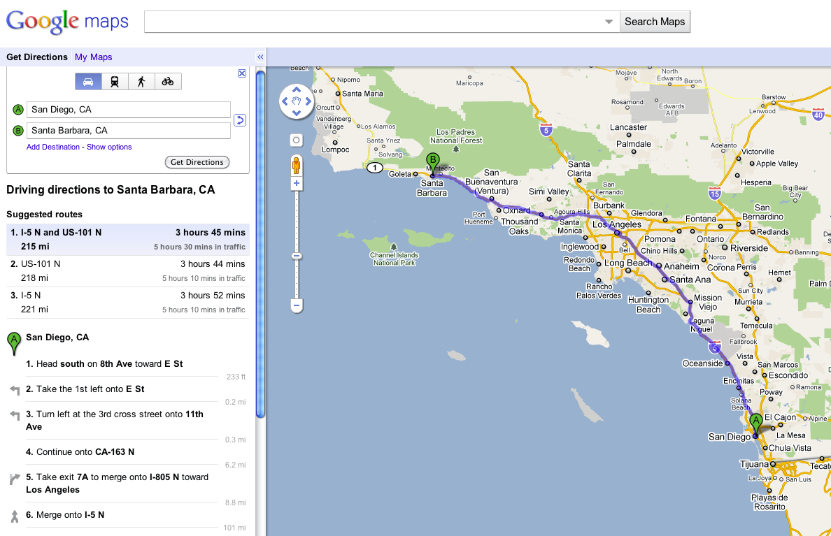
It’s easy to get a the driving distance between two places, for instance between San Diego, CA and Santa Barbara, CA
However, what if you wanted to know the distance between the two places as the bird flies? Â Luckily there is a tool in Google Maps Labs called the Distance Measurement Tool that will show you the distance in miles or kilometers between any two points on a map.
First login to your google account:
https://www.google.com/accounts/
Next go to Google Maps:
Then look in the upper right corner for the gear icon and click it then click the Maps Labs option:
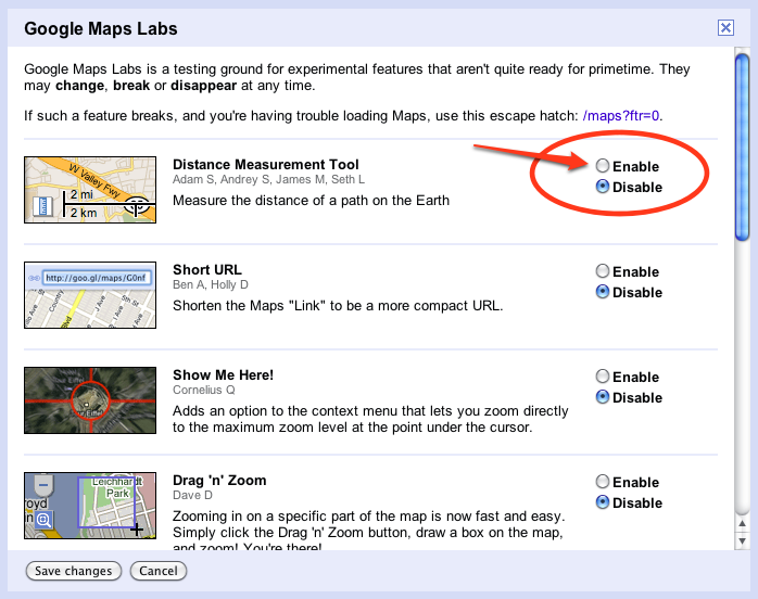
You should see the following Labs Menu, click to Enable the Distance Measurement Tool:
Click Save Changes
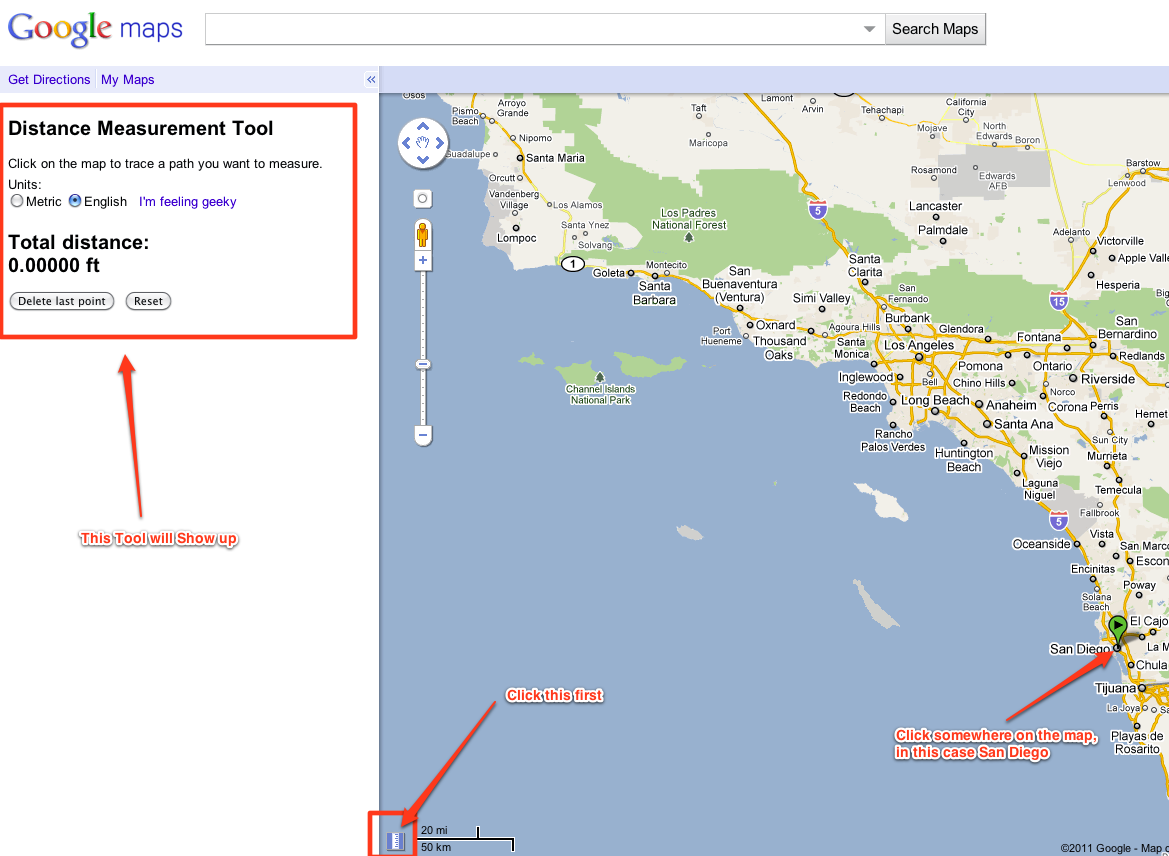
Now you should see a new “ruler” icon in the lower left corner of the map. Â Click this and the Distance Measurement Tool will show up. Â Then click any where on the map you want to start your measurement from. Â In this case I clicked San Diego, but note you do not have to click a city, you can click anywhere on the map.
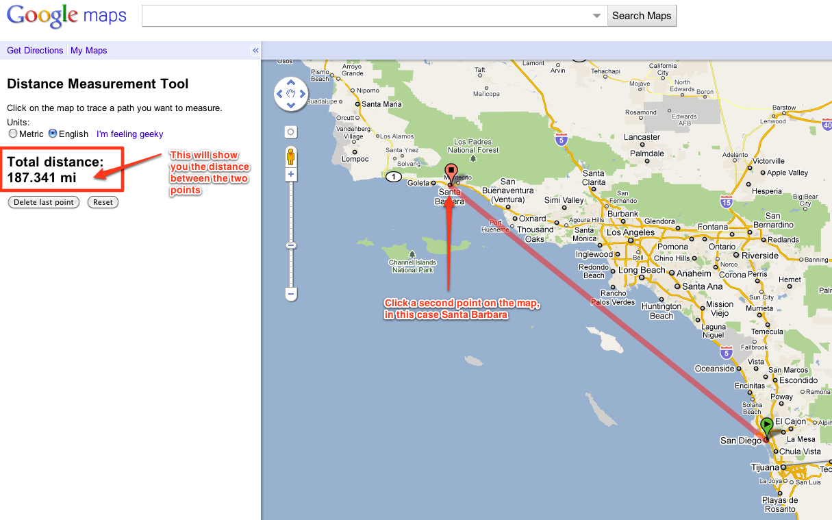
Next I clicked another point on the map, in this case Santa Barbara and the Distance Measurement Tool showed the straight line distance between the two points, in this case 187 miles. Â If you click another point on the map it will add that distance and give you the total.


2 comments
nice 1. and I have found the source code to Measure and calculate distance on Google Maps. please visit http://www.etechpulse.com/2013/07/how-to-measure-distance-between-two.html 
Great, thanks Ravi